`Ike Wai Gateway
Welcome to the ‘Ike Wai Gateway!
‘Ike Wai, Hawaiian for knowledge and water, is a National Science Foundation supported EPSCoR project that aims to help ensure Hawaiʻi’s future water security through an integrated program of research, education, community engagement, and decision support.
The project collected new hydrological and geophysical data to develop actionable and informative models of two of Hawaiʻi’s important aquifers, their water flow and transport processes. Publicly available datasets collected by the project are available to review and download here in the gateway.
Datasets
Geophysics – Continuous Ambient Noise Seismic Data
A multi‐hydrogeophysical study of a watershed at Kaiwi Coast (O‘ahu, Hawai‘i), using seismic ambient noise surface wave tomography and self‐potential data.
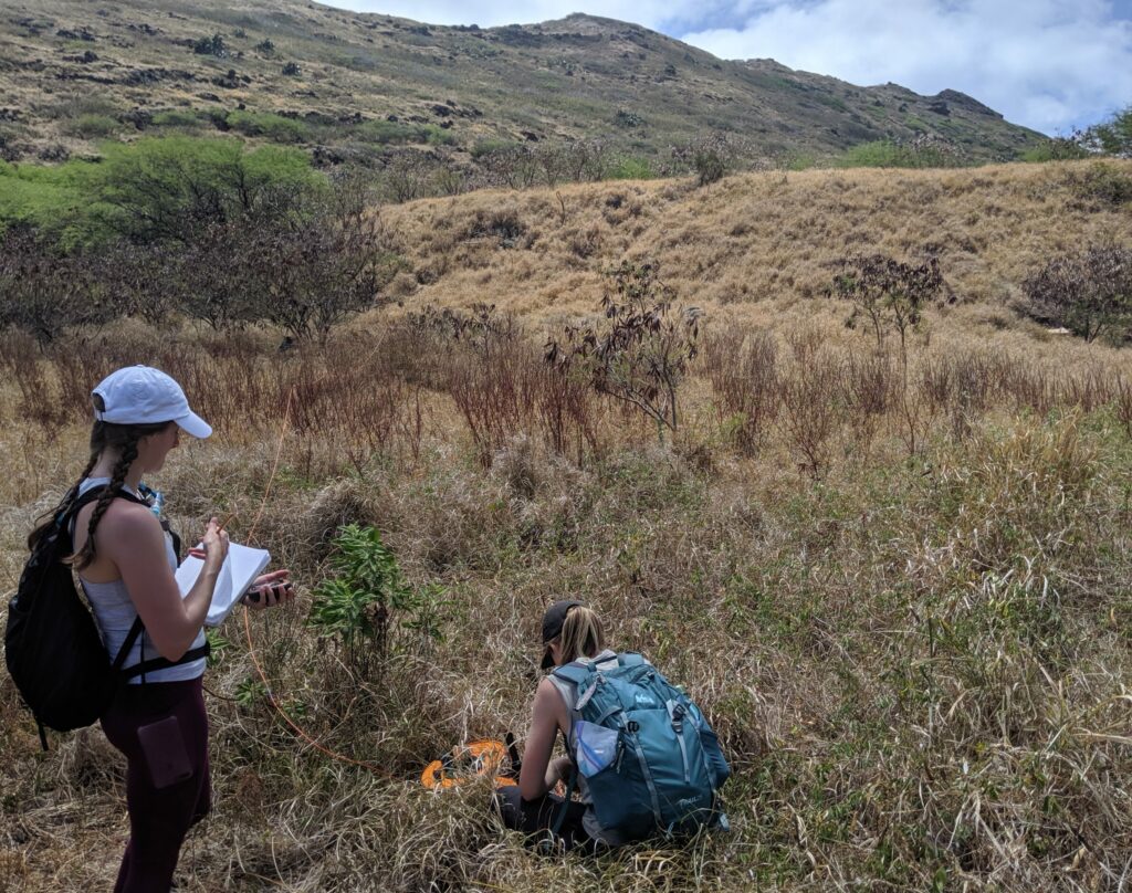
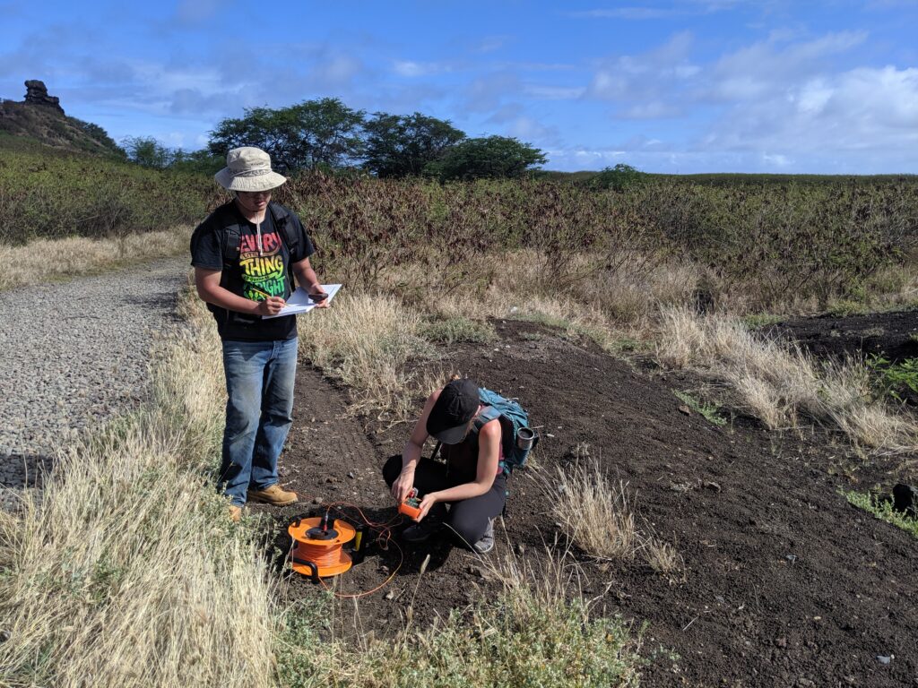
Geophysics – Makapuu/Kaiwi Coast Self Potential
Results of a Self Potential survey off Makapuu/Kaiwi Coast of Oahu. The data helps the understanding and mapping of underground water circulations.
Groundwater Chemistry: Nutrient Data
Groundwater geochemistry nutrient data, collected between November 2017 and March 2019. The dataset includes: Sample Name, Well ID, Longitude (dd), Latitude (dd), Time Stamp, pH, Temperature (C), Specific Conductance (uS/cm), Salinity, Dissolved oxygen (% and mg/L), Si (ug/L), PO4 (ug/L), NO3 & NO2 (ug/L), NH3 & NH4 (ug/L), TP (ug/L), TN (ug/L), and alkalinity (mg/L).

Groundwater Recharge – Watershed Protection
Prioritization of Hawaiʻi County watershed protection and restoration. This estimates recharge benefits through protecting native forest from invasion and conversion to non-native forest and non-native grassland.
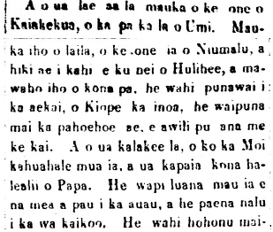
Hawaiian Language Newspaper Translations
Hawaiian Language nūpepa (newspapers) are a treasury of knowledge that document and provide insight to practices, traditions, and knowledge of old Hawaiʻi.
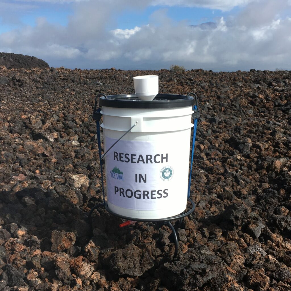
Kona Precipitation Chemistry
Precipitation chemistry data for all sampling trips in Kona, West Hawaiʻi. Data collected between August 2017 and November 2019 over twenty sites between central and west Hawaiʻi Island. The data include pH, precipitation (mm), fluoride (uM), chloride (uM), bromide (uM), sulfate (uM), sodium (uM), ammonium (uM), potassium (uM), magnesium (uM), calcium (uM), d18O (pmil) and dD (pmil).
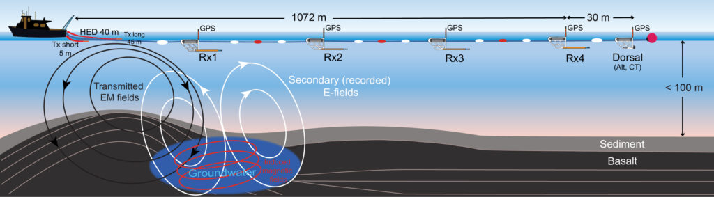
Marine Geophysics
The CSEM data acquired during an 8 day survey conducted Sep-Oct, 2019 offshore of the Kona coastline, west of Hawaii. 3 zipped files contain the following CSEM data/information: 1) CSEM raw data recordings (binary files). 2) Survey towlines time windows of the CSEM data recording. 3) Power spectrograms images of the recorded raw CSEM data.
Rainfall – Gridded Precipitation Data
Gridded monthly Standardized Precipitation Index (SPI) at 10 different time intervals from 1920 to 2012 at 250 m resolution for all main Hawaiian Islands excluding Ni’ihau.
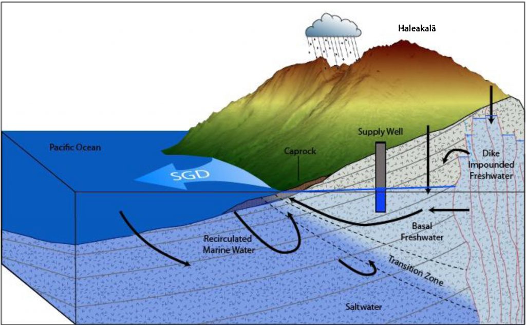
Submarine Groundwater Discharge
Submarine groundwater discharge (SGD) is groundwater leaking from a coastal aquifer into the ocean. Chemical fingerprints of SGD can inform us where the water originates, what land-use it flows under, and how much time it spends in the aquifer.
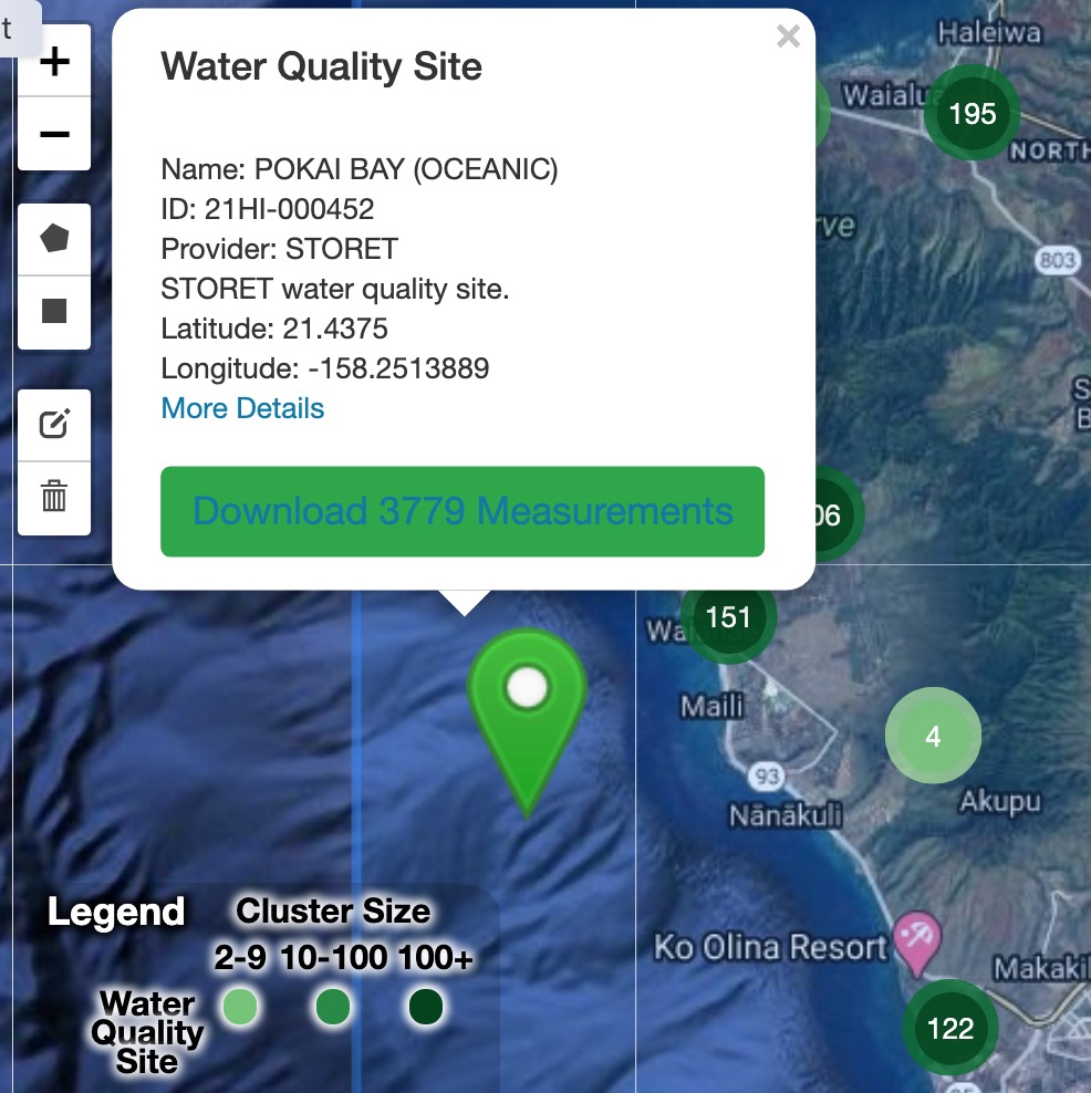
Water Quality
A collection of locations in Hawai’i for which we have water quality data. The sites are searchable by location and filterable by site ID, name, and data provider. Results are downloadable.
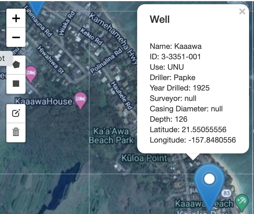
Wells
All of Hawai’i’s available well data. The data is searchable by location and filterable by name, year drilled, and well ID. Available records include drilling and water use permits. Results are available for download.
Decision Support Tools

Hawaii Precipitation Tool
A responsive, user-friendly interface to assist in accessing and visualizing Hawai’i’s available rainfall data.
`Ike Wai Science Gateway
This gateway was developed to assist `Ike Wai researchers with storing, annotating, processing, and publishing their data.

Hawai’i Groundwater Recharge Tool
An interactive tool that allows users to evaluate the potential effects of land-cover and climate changes on groundwater recharge.